LiDAR & 3D Spatial Solutions
High-density aerial and terrestrial laser scanning producing millimeter-grade coordinate accuracy. We generate rich 3D point clouds, topographic surface profiles, vegetation management surveys, and digital twins.
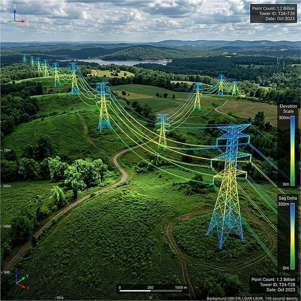
Dense 3D Point Clouds & As-Built Digital Twins
B2B infrastructure management, power transmission, and civil engineering projects demand absolute visual and structural accuracy. TerraX3D utilizes state-of-the-art Light Detection and Ranging (LiDAR) sensors. Unlike traditional photography, our active laser scanning pierces dense tree canopies, vegetation, and atmospheric layers to capture exact ground coordinates.
Active Laser Telemetry Scan
Emitting up to 100,000 laser pulses per second to record millimetric spatial coordinates.
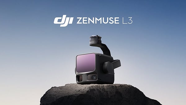
DJI Zenmuse L3 LiDAR Platform
See the capabilities of our primary aerial scanning platform. We deploy the advanced DJI Zenmuse L3 LiDAR payload to deliver unmatched topographic and structural data.
Advanced LiDAR Applications
Corridor & Transmission Surveys
Fast, high-fidelity mapping of utility corridors. We identify wire sag, utility tower deformations, and calculate vegetation encroachment clearances.
3D Point Cloud Mapping
Millions of accurate 3D points matching XYZ coordinate parameters, providing millimetric reference files for BIM pipelines and CAD design overlays.
Structural Deformation Audits
Compare sequential scans to identify millimeters of concrete settling, retaining wall shifts, or steel structure bends over time.
LiDAR Deliverables & Integrations
Classified LAS/LAZ Point Clouds
Separated into distinct, layered classifications: bare ground, high/low vegetation, structures, and overhead conductors.
DEM and DTM Datasets
Digital Elevation Models and Digital Terrain Models mapping the precise bare earth topography completely stripped of foliage.
Scan-to-BIM Revit Files
High-precision structural meshes detailing as-built steel geometries, duct configurations, and structural concrete layers.
Vegetation Penetration & Multi-Return Technology
Our high-end LiDAR sensors record multiple pulse returns. When the laser hits a canopy, some energy returns while the rest continues down through branches. This multi-return system maps both tree heights and the exact bare earth topography simultaneously.
This data structure allows engineers to model structural clear zones under transmission lines, calculate excavation volumes in dense forests, and run splay/drainage calculations without clearing site trees first. We output standard coordinate mapping systems (WGS84, Hartebeesthoek94) ready to import straight to CAD.
Advanced Capabilities
Vegetation Penetration
Our sensors record multiple returns, scanning through foliage to map ground features.
Deformation Analysis
Compare temporal scans to identify structural wall shifts or steel warps.
GIS & CAD Ready
Seamless integration with civil spatial coordinate systems (WGS84, Hartebeesthoek94).
Need Subsurface Locating?
Complete your pre-construction survey with non-destructive GPR scanning to avoid utility strikes.
Explore Subsurface →3D Laser & BIM Guides
LiDAR & Scan-to-BIM Technical Resources
3D LiDAR & Laser Scanning Contractors in Johannesburg & Pretoria
Accuracy standards, LOD 200–400 Revit deliverables, and ZAR per-m² rate cards for terrestrial and aerial LiDAR in Gauteng.
Scan-to-BIM & Revit Point Cloud Modeling for Brownfield Refurbishments
Converting millimetric E57 and RCP laser point clouds into clash-free Autodesk Revit and Navisworks models.
High-Voltage Powerline Corridor LiDAR, Sag & Encroachment Auditing
Using DJI Zenmuse L3 aerial LiDAR to audit overhead conductor catenary sag and vegetation clearance across South Africa.
Frequently Asked Questions
Get answers to common inquiries about LiDAR scanning and 3D spatial modeling.
What is the difference between LiDAR and photogrammetry?
Photogrammetry stitches overlapping optical photographs to map visible surfaces in open terrain, whereas LiDAR emits up to 100,000 active laser pulses per second to penetrate vegetation canopies and capture millimetric 3D structural and bare-earth coordinates.
Can LiDAR scan through vegetation or dense tree canopies?
Yes. Multi-return aerial LiDAR sensors record up to five echoes per laser pulse, allowing energy to filter through dense bushveld and forest canopies to map the true bare-earth Digital Terrain Model (DTM) underneath.
What point cloud formats do you deliver?
Standard 3D laser scanning deliverables include classified LAS and LAZ point clouds, registered E57 and Autodesk RCP/RCS scans, Revit Scan-to-BIM models (LOD 200 to LOD 400), and Civil 3D DWG topographic contours.
Do you perform tower tilt and sag analysis?
Yes. Using high-density DJI Zenmuse L3 aerial and terrestrial LiDAR scans, we measure sub-millimetric transmission tower verticality, steel deflection, insulator clearances, and overhead powerline catenary sag vectors.
Ready to Capture Millimetric Spatial Data?
Speak with our spatial data technicians to formulate a site capture, utility locate, or point cloud mapping brief.